
What draft can your vessel operate at in Suape? The answer depends on its access route, assigned berth, tide and manoeuvring conditions. The full passage, from pilot boarding to the berth and back to sea, needs to be assessed.
Suape’s new depths now appear in Portaria No. 190/2026, signed on 30 September 2026. Shipowners, charterers and operators planning calls at Suape should check that portaria and the ramp-up rules for the dredged channel described below.
Importers and exporters also have a stake in these developments. Changes in port access can influence vessel deployment and the services available to move their cargo.
For pilotage, berths, clearance and crew changes at Suape, see our Port of Suape guide.
Dredging strengthens Suape’s role in regional trade
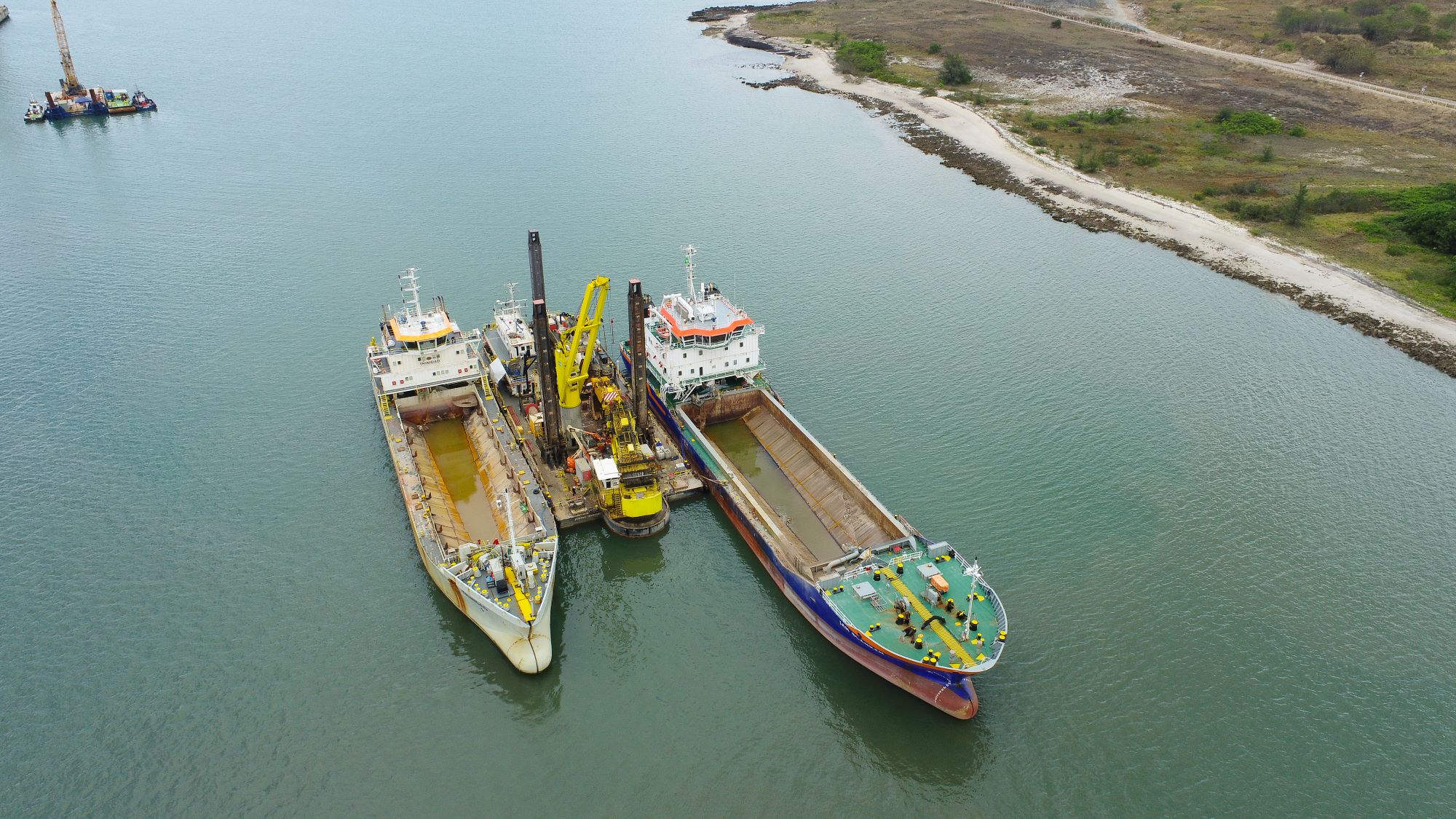
Suape completed the dredging of its internal channel, turning basin and liquid bulk piers 3A and 3B in January 2026. In a release of 19 October 2026, the port authority put the investment at R$247 million: R$100 million from the Ministry of Ports and Airports through the Novo PAC programme and R$147 million of Suape’s own funds. The same release reports that the Brazilian Navy has approved the new depths. Source: Porto de Suape, 19 October 2026.
Deeper access can broaden vessel and cargo-planning options, but terminal capacity, berth availability and the vessel’s particulars still determine what is feasible for a specific call. Suape also states that fuller cargo intake for container ships of up to 366 metres, which already call at the port, still depends on a manoeuvrability study planned for later in 2026.
The port authority’s release explains the investment. The portaria provides the operational parameters to check before planning the voyage.
What Portaria No. 190/2026 establishes
Signed on 30 September 2026, Portaria No. 190/2026 sets out Suape’s parameters for conventional manoeuvres, operating capacities, maximum drafts and operational restrictions. Its Article 3 revokes Portaria No. 182 of 31 August 2026, which earlier versions of this article cited. Its preamble keeps in force the port authority’s earlier portarias on specific operating conditions: Nos. 136/2019, 005/2020, 037/2021, 044/2021, 063/2021 and 022/2022. Check whether one of them applies to your vessel.
The document covers the access channels, navigation and turning areas, individual berths, the buoyage and vessel-specific requirements of the dredged external channel, pilot boarding positions, mooring, night operations, and visibility and wind restrictions. Its Annex II maps the dredged areas. Read the complete official Portaria No. 190/2026 (PDF, Portuguese).
A vessel that meets the entrance-channel requirements must also meet the requirements for its route and assigned berth. The dredged channel is intended mainly for vessels with a draft above 14.0 metres, except during the ramp-up period described below, when the draft limits of Portaria No. 103/2025 apply. A vessel with a smaller draft may use the channel only with prior authorisation from the port authority (item 2.4).
Channel depth is not the vessel’s allowable draft
The portaria describes the dredged external access channel as 6.4 kilometres long, with a minimum width of 210 metres and a minimum depth of 20 metres.
A 20-metre channel depth does not mean a vessel may operate at 20 metres of draft.
Annex I distinguishes two calculations:
| Term in the portaria | Planning meaning |
|---|---|
| CMR (Calado Máximo Recomendado) | Maximum recommended navigation draft, considering the relevant depth, under-keel clearance and tide at the time of passage. |
| CMA (Calado Máximo de Atracação) | Maximum berthing draft, considering the berth parameters, under-keel clearance and the applicable minimum tide over the stay. |
For the berthing calculation, the period starts on the day of berthing and ends 48 hours after the expected day of sailing. The portaria also states that the maximum recommended draft is limited by the CMA of the berth being used.
Assess the arrival window against the conditions expected throughout the stay, not just at entry.
The route to the berth matters
Suape’s operational areas have different characteristics. The portaria distinguishes the external access channels, external and internal navigation areas, turning basins and approach sections.
A vessel assessment therefore needs to follow the intended route rather than rely on the deepest point shown in a port description.
The berth tables add further parameters, including length overall, deadweight, depth and maximum berthing draft at zero tide. Their notes and conditions matter as much as the headline figures. A vessel whose dimensions exceed the parameters in the portaria can manoeuvre only under special conditions, after analysis and validation by the Maritime Authority, the port authority and the pilots (item 1.8).
Before confirming a nomination or cargo condition, check that the vessel can complete the planned arrival, stay and departure within the applicable limits.
Suape tide tables: planning beyond high water
The Brazilian Navy publishes a 2026 tide table for Porto de Suape, providing predicted tidal times and heights. The Suape table expresses times in UTC−3, an important detail when coordinating with teams working in other time zones. Official Porto de Suape tide table.
The portaria takes its tidal inputs from this table:
- For passage, the CMR formula uses the predicted tide height at the time of transit.
- For berthing, the CMA formula uses the lowest tide in the period that starts on the day of berthing and ends 48 hours after the expected day of sailing.
The notes to the portaria’s tables refer to the observed tide instead, so confirm with the pilots which value they will apply.
A high-water arrival alone does not establish a suitable draft for the entire stay.
Tidal predictions are not real-time water-level observations or confirmation of the vessel’s permissible draft. They must be considered with the applicable operational requirements and current conditions.
Vessel-specific restrictions and tug requirements
For the dredged external channel, the portaria includes specific provisions for Suezmax and Aframax tankers, Capesize bulk carriers and container ships.
Depending on the vessel category, these address size limits, seasonal conditions, significant wave height, entry and departure drafts, wind and current limits, tug configurations and Portable Pilot Unit requirements. Container ships need two pilots. If the wave-height measuring device fails, the most conservative draft applies.
Portaria SUAPE No. 103/2025, signed on 2 October 2025, set a progressive operation period (ramp-up) for the dredged external channel. We found no later act that ends it, and Portaria No. 190/2026 still provides for it. During the ramp-up, item 2.4 says the draft limits are those of a separate portaria, which for this channel is No. 103/2025, and item 2.5.3.2 sets a wind limit of 15 knots for Capesize bulk carriers, against 20 knots at other times.
Portaria No. 103/2025 opens the channel in six blocks, each reviewed with the Maritime Authority and the pilots 15 days before it ends. Length limits start at 200 metres and rise in steps to 275 metres in the fifth block. In that block the draft limit is 15.57 metres for vessels with dynamic positioning and 15.30 metres for conventional vessels. The sixth and last block admits Suezmax tankers, with the operating draft limited to the simulated maximum of 17.30 metres. We found no public notice of the block in force, so confirm it with the port authority or the pilots before fixing a length or draft. Read Portaria No. 103/2025 (PDF, Portuguese).
Portaria No. 190/2026 also addresses night operations and mooring arrangements. It deactivates the former pilot boarding point, which lay in the middle of the dredged channel, and sets two new ones: point E for the dredged channel and point NE for the natural channel, with coordinates in its Table 9.
Tug use follows Portaria SUAPE No. 022/2022, and the dredged-channel provisions add a minimum bollard pull for each vessel category. During the ramp-up, Portaria No. 103/2025 (Article 4) also requires the towage companies to have a tug ready to pass its line before the vessel enters the channel; passing the line is optional for smaller vessels, but the tug must still be available. Confirm the tug configuration and terminal arrangements against the intended manoeuvre and the vessel’s condition.
Separately from the dredged-channel rules, any manoeuvre in the port needs visibility above 500 yards, and berthing in the outer basin is not allowed with mean wind above 20 knots. A draft value from a table should not be used independently of the accompanying environmental limits and notes. Where provisions require clarification, the operational interpretation should be confirmed with the relevant authorities and pilotage service.
Official nautical chart: Porto de Suape
The Brazilian Navy’s Chart 912, Porto de Suape, is available through the Navy Hydrographic Center in raster and GeoTIFF formats. Official Chart 912 download page.
The chart and the portaria serve different purposes. The chart provides hydrographic and geographic information; the portaria establishes operational parameters and restrictions. Neither should be treated as a substitute for the other.
Users should check the chart’s edition and correction status against applicable Notices to Mariners. The CHM specifically states that its GeoTIFF files are supplied for academic purposes and must not be used as navigational aids because they are not regularly updated. CHM raster-chart guidance and GeoTIFF notice.
Information to provide before the call
For a preliminary assessment, provide:
- Vessel name, IMO number, type and size class (for example Suezmax tanker or Capesize bulk carrier), length overall, beam and deadweight.
- Expected arrival and departure drafts, and whether the vessel has dynamic positioning.
- Type of mooring lines (steel wire or synthetic).
- Intended terminal or berth, cargo operation, and whether the vessel will berth alongside another vessel.
- ETA, expected sailing date and whether manoeuvres are planned by day or by night.
- Relevant manoeuvring limitations and required shore-side or technical support.
These particulars allow the parties to assess vessel suitability, coordinate cargo movements and identify any local arrangements needed before arrival.
Costa Maritime support at Suape
At Costa Maritime, we coordinate local arrangements and shore-side support around the vessel’s intended operation. We work from the vessel particulars, service scope and expected dates to identify what needs to be arranged locally.
We help the vessel’s team obtain the relevant information and coordinate with the parties involved. Operational decisions and approvals remain with the responsible authorities, terminal and pilotage service.
Planning a Suape port call?
Contact Costa Maritime with the vessel particulars, expected drafts, ETA and intended operation to discuss the local coordination and support required.
Portaria No. 190/2026 applies together with the Pernambuco Harbour Master’s standards (NPCP-2021/PE, as revised on 23 June 2026), the ramp-up rules in Portaria No. 103/2025 and earlier Suape portarias, including No. 022/2022 on tug use. This article is an informational planning overview, not navigational guidance, operational clearance or a guarantee of vessel acceptance or turnaround time. Consult the complete official documents, applicable notices and current operational information for the proposed call.